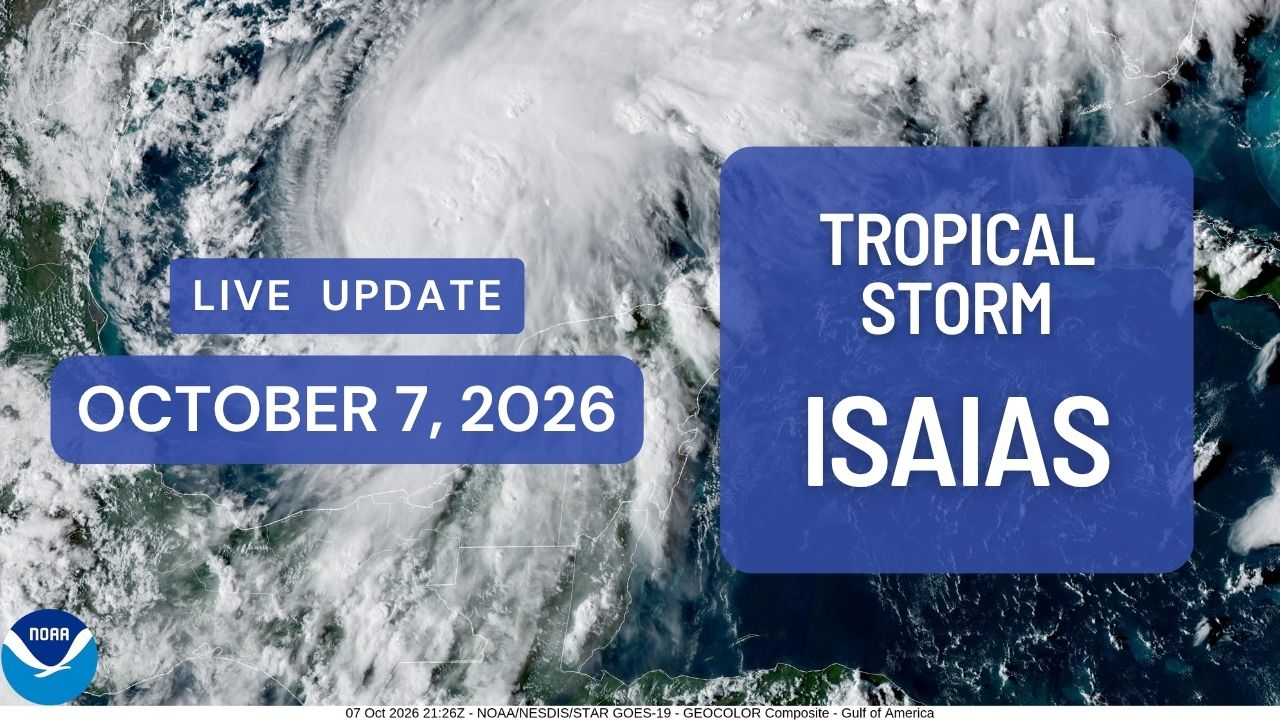
Forecast update: 4 p.m. CDT Wednesday, Oct. 7, 2026. All times below are CDT.
Tropical Storm Isaias strengthened to 65 mph Wednesday afternoon and is forecast to become a hurricane by Thursday morning before making landfall along the northern Gulf Coast late Friday or early Saturday.
The storm’s maximum sustained winds increased from 45 mph in the morning to 65 mph in the National Hurricane Center’s 4 p.m. advisory. Isaias remained a tropical storm, with further strengthening expected through Friday morning.
At 4 p.m., the center was about 500 miles south-southwest of the mouth of the Mississippi River and moving east-northeast at 8 mph. Tropical-storm-force winds extended up to 60 miles from the center.
Latest track and landfall timing
Isaias is expected to continue east-northeast Wednesday, then turn northeast Thursday and north Friday. The center should pass north of Mexico’s Yucatan Peninsula Thursday, Oct. 8, before reaching the U.S. northern Gulf Coast late Friday, Oct. 9, or early Saturday, Oct. 10.
The latest forecast discussion shifted the projected track slightly east. The official forecast shows maximum sustained winds near 110 mph over the Gulf Friday afternoon, followed by weakening as the storm moves inland.
The exact landfall location and strength remain uncertain. Forecasters said most guidance still shows a Category 1 or Category 2 hurricane at landfall, even though less favorable upper-level winds could limit its strength Friday. Residents should continue following the full forecast rather than focusing on a single point along the projected track.
Coastal watches remain in effect
The hurricane center made no changes to watches in the 4 p.m. advisory:
- A hurricane watch covers the coast from Bay St. Louis, Mississippi, to Indian Pass, Florida.
- A storm surge watch extends from the mouth of the Mississippi River to Yankeetown, Florida.
- A tropical storm watch covers the coast from Louisiana’s Jefferson/Plaquemines Parish line to west of Bay St. Louis, and from east of Indian Pass to the Aucilla River in Florida.
Tropical storm conditions could begin in the coastal watch areas by midday Friday. Hurricane conditions could begin in the hurricane watch area late Friday. A watch means the specified hazardous conditions are possible.
Storm surge and heavy rain
If peak surge arrives at high tide, water could rise 5 to 7 feet above ground somewhere along the coast from Ocean Springs, Mississippi, to Indian Pass, Florida, including Mobile Bay.
The updated forecast calls for 4 to 6 feet from Indian Pass to the Steinhatchee River in Florida. Other surge estimates are 3 to 5 feet from the mouth of the Mississippi River to Ocean Springs, 2 to 4 feet from the Steinhatchee River to Yankeetown, and 1 to 3 feet at Lake Pontchartrain. Actual flooding will depend on the track, tides and local conditions.
From Friday through the weekend, Isaias could bring 3 to 7 inches of rain, with localized totals up to 10 inches, across the central Gulf Coast from far southeastern Louisiana to the Florida Panhandle.
Across much of the broader Southeast, 1 to 3 inches are possible, with localized totals up to 5 inches, as far north as the Tennessee Valley and the Carolinas. Flash flooding, urban flooding and isolated river flooding are possible. These regional estimates will vary by location.
Tornado potential increases Friday night
The hurricane center said tornado potential will increase as Isaias’ rain bands approach the northeastern Gulf Coast Friday evening and overnight. That potential will spread inland Saturday as the storm continues north.
Swells spreading toward the Gulf Coast late this week could also cause life-threatening surf and rip currents.
Residents in the watch areas should follow local emergency instructions and evacuate if told to do so. The hurricane center also urged those facing hurricane conditions to prepare for potentially lengthy power outages.
The next intermediate advisory is scheduled for 7 p.m. Wednesday, followed by the next full advisory at 10 p.m.