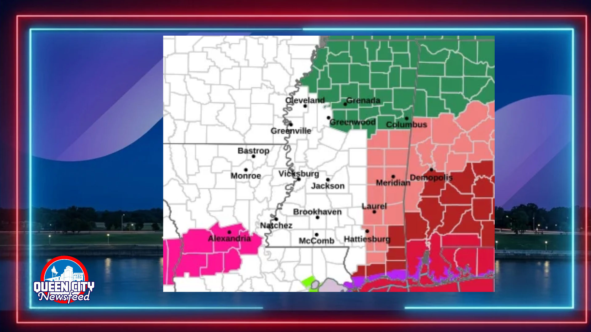
MERIDIAN, Miss. (Queen City Newsfeed), The National Weather Service expanded its tropical storm alerts Thursday afternoon, and Lauderdale and Neshoba counties now sit under a Tropical Storm Watch as Hurricane Isaias moves toward the Gulf Coast.
The new watch covers much of East Mississippi. It includes Lauderdale, Neshoba, Kemper, Newton, Clarke, Jasper, Jones, Noxubee and Winston counties. Wayne County remains under the watch issued earlier Thursday.
A Tropical Storm Watch means tropical storm force winds are possible somewhere in the area within the next 48 hours.
What to Expect in Lauderdale and Neshoba Counties
Forecasters expect winds of 15 to 25 mph in Lauderdale and Neshoba counties, with gusts near 35 mph. However, the weather service says winds of 39 to 57 mph remain possible. Residents should prepare for downed limbs, a few snapped trees and scattered power outages.
Lauderdale County, including Meridian, falls under a Flood Watch. Forecasters expect 2 to 4 inches of rain there, with higher amounts in some spots.
Neshoba County, including Philadelphia, could see 1 to 3 inches of rain. Still, forecasters warn that creeks and ditches may overflow and some roads may close.
The weather service urges residents in both counties to start preparing now, before the wind becomes hazardous. Secure outdoor furniture, trash cans and other loose items. Forecasters do not expect tornadoes in either county.
Other East Mississippi Counties
Forecasters issued similar wind forecasts across the region, with gusts near 35 mph in most counties. Rainfall totals vary:
- Kemper, Noxubee and Winston counties: 2 to 4 inches of rain under a Flood Watch.
- Clarke County: 1 to 3 inches of rain under a Flood Watch.
- Newton and Jasper counties: 1 to 3 inches of rain.
- Wayne County (Waynesboro): Gusts near 40 mph and 1 to 3 inches of rain.
- Jones County: Gusts near 35 mph and around 1 inch of rain.
In every Mississippi county under the watch, forecasters say winds of 39 to 57 mph remain possible. Tornadoes are not expected.
Wayne County residents can reach their county EMA at 601-735-2185.
Marengo County Upgraded to Tropical Storm Warning
Across the state line, the weather service upgraded Marengo County, Alabama, to a Tropical Storm Warning. That alert covers Demopolis and Linden.
Forecasters now expect gusts up to 50 mph in Marengo County. They also raised rainfall totals there to 3 to 6 inches under a Flood Watch. On the other hand, forecasters lowered the tornado threat and no longer expect tornadoes.
Clarke County, Alabama, remains under a Tropical Storm Warning as well. Forecasters expect gusts up to 50 mph, and winds between 58 and 73 mph remain possible. The county could see 3 to 6 inches of rain, and forecasters warn that major flooding could force evacuations and rescues. Clarke County, Alabama, residents can call their EMA at 251-275-8775.
West Alabama Watches Continue
Tropical Storm Watches remain in effect for five other west Alabama counties:
- Sumter County (Livingston): Gusts near 40 mph. Forecasters raised rainfall totals to 3 to 6 inches under a Flood Watch.
- Choctaw County (Butler, Lisman, Silas): Gusts near 35 mph and 3 to 6 inches of rain under a Flood Watch.
- Hale County (Greensboro, Moundville): Gusts near 45 mph and 2 to 4 inches of rain. Forecasters lowered the tornado threat and no longer expect tornadoes.
- Greene County (Eutaw): Gusts near 40 mph and 2 to 4 inches of rain.
- Pickens County (Carrollton): Gusts near 40 mph and 2 to 4 inches of rain.
Choctaw County, Alabama, residents can reach their EMA at 205-459-2153.
Queen City Newsfeed will continue to follow Isaias and bring you updates as conditions change.