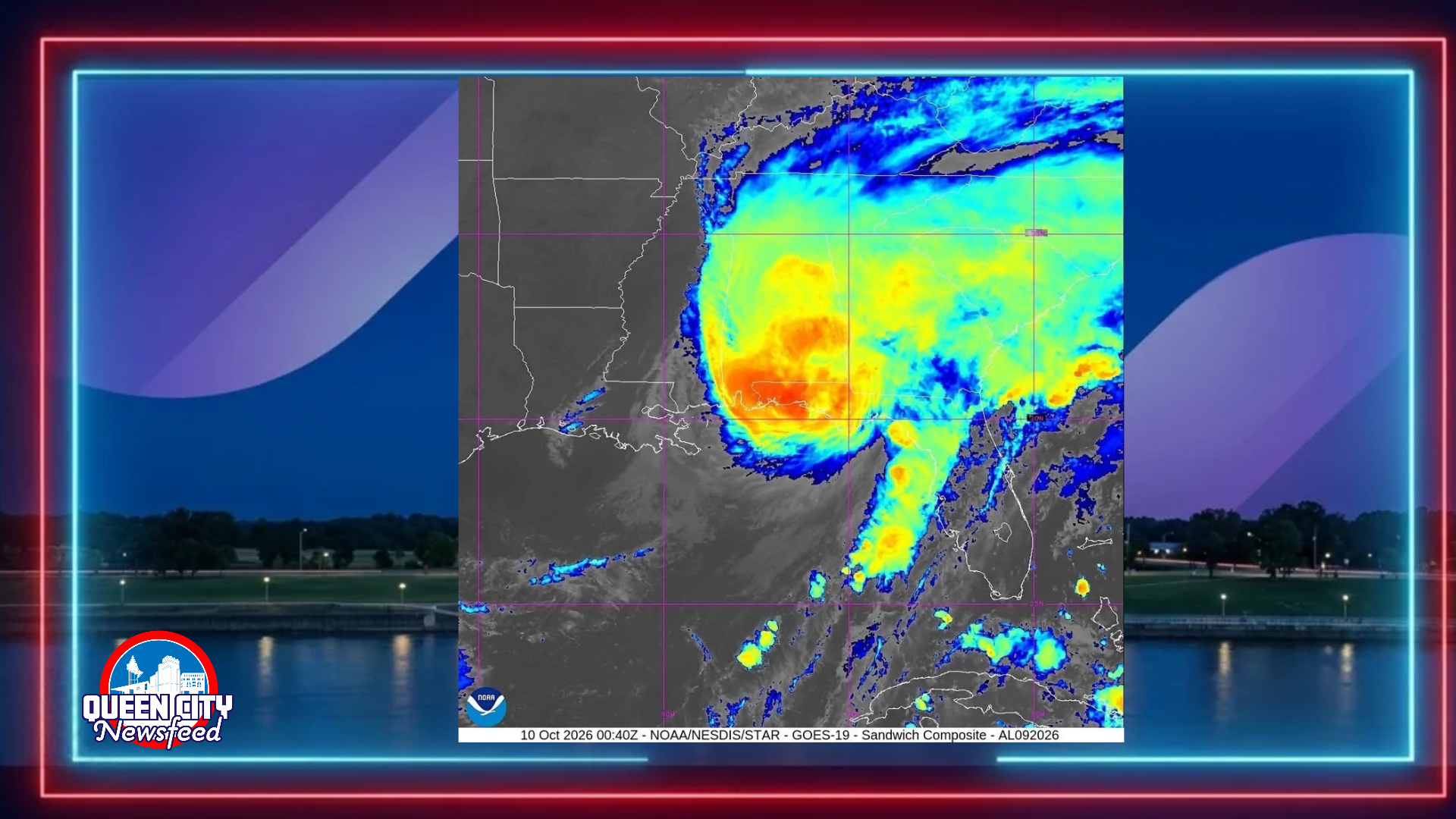
MERIDIAN, Miss. (Queen City Newsfeed) Hurricane Isaias made landfall near Destin, Fla., at 8:30 p.m. Friday. The National Hurricane Center says the Category 2 storm came ashore with top winds of 105 mph.
Dangerous storm surge is hitting the Gulf Coast from Mobile Bay to Panama City Beach. Hurricane conditions and flash flooding are now spreading inland.
Latest from the National Hurricane Center
Isaias weakened a little before it reached the coast. Here is what the hurricane center reported at landfall:
- Landfall: near Destin, Fla., at 8:30 p.m.
- Category: 2, down from Category 3 earlier Friday
- Top winds: 105 mph
- Movement: north at 19 mph
Now that it is over land, Isaias is expected to move north across Alabama. It should reach the Tennessee Valley on Saturday and Sunday. The storm is expected to weaken quickly over land and lose its hurricane strength on Saturday. Still, hurricane force winds could reach as far as 100 miles inland into southern Alabama.
Conditions along the Gulf Coast
The eyewall, the most dangerous part of the storm, moved ashore Friday evening. It brought destructive winds, rising water and heavy rain.
- Wind: Pensacola City Hall recorded a 102 mph gust. A gust of 96 mph was measured on Pensacola Bay. In nearby Gulf Breeze, a weather station measured 83 mph winds with a 97 mph gust. Destin and Perdido Bay each saw gusts of 75 mph. Orange Beach, Ala., recorded a 72 mph gust. Severe wind damage was reported in Escambia and Santa Rosa counties.
- Storm surge: The water at Panama City Beach climbed to 5.4 feet above normal tide and was still rising. In Destin, rising water tore away a boardwalk. Forecasters warn water could rise 6 to 9 feet from the Alabama and Florida state line to Grayton Beach. Water in Mobile Bay was pushed lower than normal early on. That is expected to change as the winds shift.
- Flooding: The National Weather Service issued a Flash Flood Emergency for the Florida Panhandle. The most dangerous flooding is centered on Destin in Okaloosa County. The emergency runs into early Saturday.
- Power outages: More than 400,000 homes and businesses were without power Friday night, most of them in Florida. Tens of thousands more were out in Alabama, mostly in Mobile and Baldwin counties. Baldwin EMC pulled its crews from the field because of trees on power lines.
- Curfews: Mobile is under a mandatory curfew overnight into Saturday morning.
What it means for East Mississippi and West Alabama
The center of Isaias is expected to pass east of our area. Even so, strong wind gusts and heavy rain will spread inland overnight.
- Tropical Storm Warnings are in effect for Lauderdale, Neshoba, Kemper, Newton, Clarke, Jasper, Jones, Wayne, Winston and Noxubee counties in Mississippi. Sumter and Choctaw counties in Alabama are also under a warning.
- Wind Advisories cover Scott, Smith, Leake and Attala counties through 7 p.m. Saturday.
- Flood Watches are in effect for Lauderdale, Kemper, Clarke, Winston, Noxubee and Attala counties through 7 p.m. Saturday. In Alabama, Choctaw County is under a Flood Watch through 1 p.m. Saturday. Sumter County is under one through 7 a.m. Sunday.
In Meridian, the National Weather Service expects winds from the north and northeast at 15 to 25 mph tonight. Gusts could reach 45 mph. Heavy rain will mainly fall after 9 p.m. Up to 1 inch of rain is possible overnight. On Saturday, winds will shift to come from the west and northwest, with gusts up to 40 mph. The showers should end Saturday afternoon.
In Sumter County, Ala., 1 to 2 inches of rain is possible tonight.
Stay safe tonight
The strongest winds in our area are expected overnight into early Saturday. Gusts this strong can bring down trees and power lines. Please take these steps:
- Stay indoors.
- Stay off the roads if you can.
- Never drive through flooded roads.
- Keep your phone charged.
- Have a way to get weather alerts overnight.
If you lose power, report it to your power company. Stay away from downed power lines and call 911 for emergencies.
Check on your neighbors, especially older neighbors and people who live alone.
Queen City Newsfeed will keep updating this story as Isaias moves inland.
Sources: National Hurricane Center Advisory 13A and 8:30 p.m. landfall update; National Weather Service offices in Jackson, Mobile and Birmingham; Fox Weather, CNN, NBC News, ABC News and Weather.com live coverage.