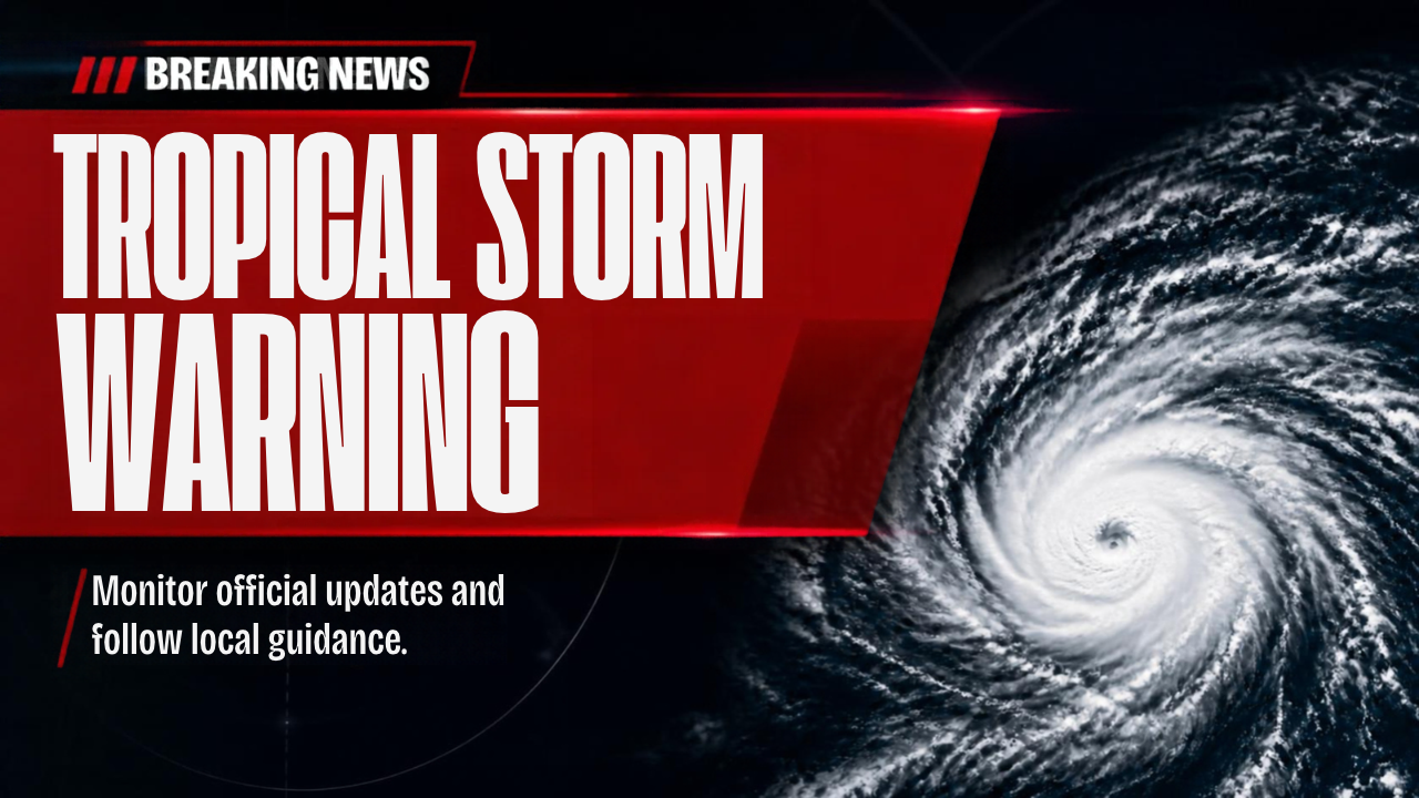
MERIDIAN, Miss. (Queen City Newsfeed), Much of East Mississippi and West Alabama is now under a Tropical Storm Warning as Hurricane Isaias moves toward the northern Gulf Coast.
The National Weather Service issued the warning for these counties:
- Mississippi: Clarke, Jasper, Jones, Kemper, Lauderdale, Neshoba, Newton, Noxubee, Wayne and Winston
- Alabama: Choctaw, Clarke, Greene, Hale, Marengo, Pickens and Sumter
A Tropical Storm Warning means tropical storm force winds are expected somewhere in the area within the next 36 hours.
A Flood Watch is also in effect for Clarke, Kemper, Lauderdale, Noxubee and Winston counties in Mississippi. In Alabama, the Flood Watch covers Choctaw, Clarke, Greene, Hale, Marengo, Pickens and Sumter counties.
Where Isaias Is Now
The National Hurricane Center said Isaias is a strong Category 3 storm with top winds of 120 mph. At 1 p.m. Friday, the storm sat about 145 miles south of Pensacola, Florida. It was moving north northeast at 16 mph.
Forecasters expect Isaias to make landfall this evening. A Hurricane Warning stretches from Ocean Springs to the Florida Panhandle. The storm should begin to weaken tonight once it moves over land.
Landfall will happen well to our south. Still, strong winds and heavy rain will reach Meridian, Philadelphia and much of our area tonight into Saturday.
Strongest Winds Near the Alabama Line
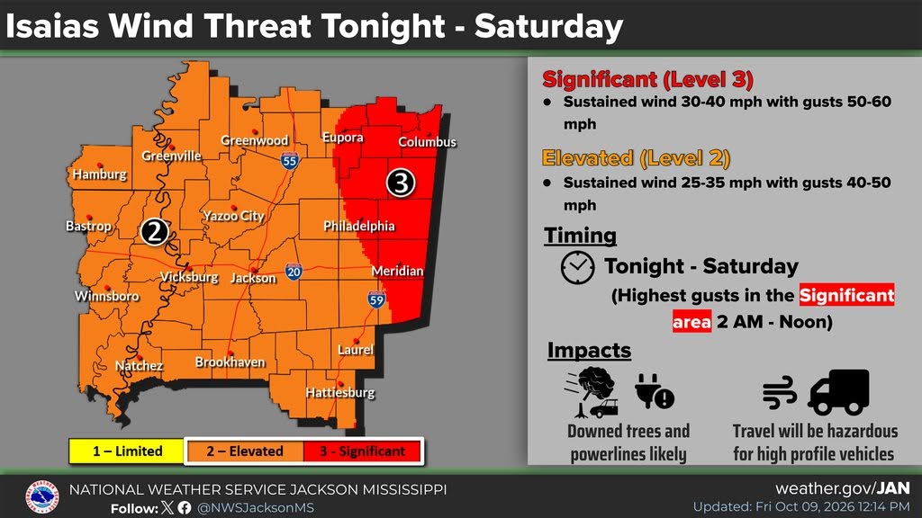
The weather service in Jackson placed Mississippi counties along the Alabama line in its highest wind risk, Level 3 of 3. That area runs from the Columbus area south to just east of Meridian. Winds there could blow 30 to 40 mph, with gusts of 50 to 60 mph. The strongest gusts should hit between 2 a.m. and noon Saturday.
Meridian, Philadelphia and the rest of our Mississippi area fall under Level 2 of 3. Expect steady winds of 25 to 35 mph, with gusts of 40 to 50 mph.
What the Wind Could Do
The weather service warns that the wind could:
- Damage porches, carports, awnings, sheds and mobile homes that are not tied down
- Break off large tree limbs and knock over some trees
- Block some roads with debris
- Make driving on bridges and overpasses dangerous
- Cause scattered power and phone outages
Travel will also be dangerous for tall vehicles, such as box trucks, vans and anything pulling a trailer.
Be Ready for Power Outages
Downed trees can cause power outages across the region. If your power goes out, report it to your power company. East Mississippi Electric Power Association (EMEPA) and Mississippi Power serve much of our area. Charge your phones and backup batteries now. Stay far away from any downed power line.
Flash Flooding Possible
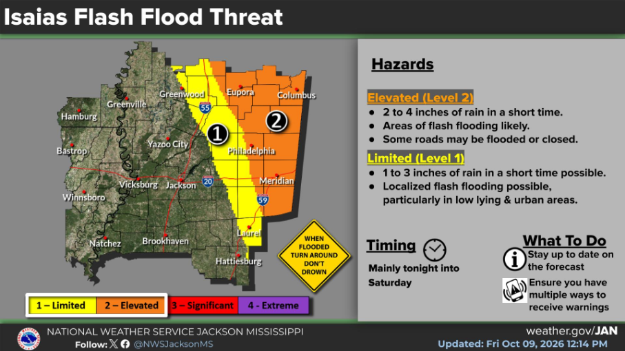
Heavy rain is a serious concern. The weather service put the Meridian, Columbus and Eupora areas under Level 2 of 4 for flash flooding. In those areas, 2 to 4 inches of rain could fall in a short time. Flash flooding is likely, and some roads may flood or close.
Philadelphia sits right along the edge between Level 1 and Level 2. In Level 1 areas, 1 to 3 inches of rain could cause flooding in low spots and in town.
Creeks, streams and ditches could overflow. Water could cover underpasses, low spots and streets with poor drainage. Some roads and bridges may close. In the worst spots, water could get into buildings, and rescues are possible.
The heaviest rain should fall tonight into Saturday. Never drive through water on a road. Turn around, don’t drown.
Tornadoes Not Expected
There is some good news. The weather service says conditions do not favor tornadoes in any of the counties under the warning. Gusty showers and storms could still move through, so keep an eye on the forecast.
What You Should Do Now
- Bring in or tie down patio furniture, trash cans and anything wind can pick up.
- Charge phones and keep a flashlight handy.
- Make sure you have more than one way to get weather warnings.
- Avoid travel tonight and Saturday morning if you can, especially in tall vehicles.
- If you live in a flood prone area, have a plan to get to higher ground.
- Check on elderly neighbors and family members.
Stay Updated
The National Hurricane Center will release its next full update at 4 p.m. Friday. You can also follow the National Weather Service in Jackson at weather.gov/JAN. Queen City Newsfeed will keep you updated as Isaias moves through our area.