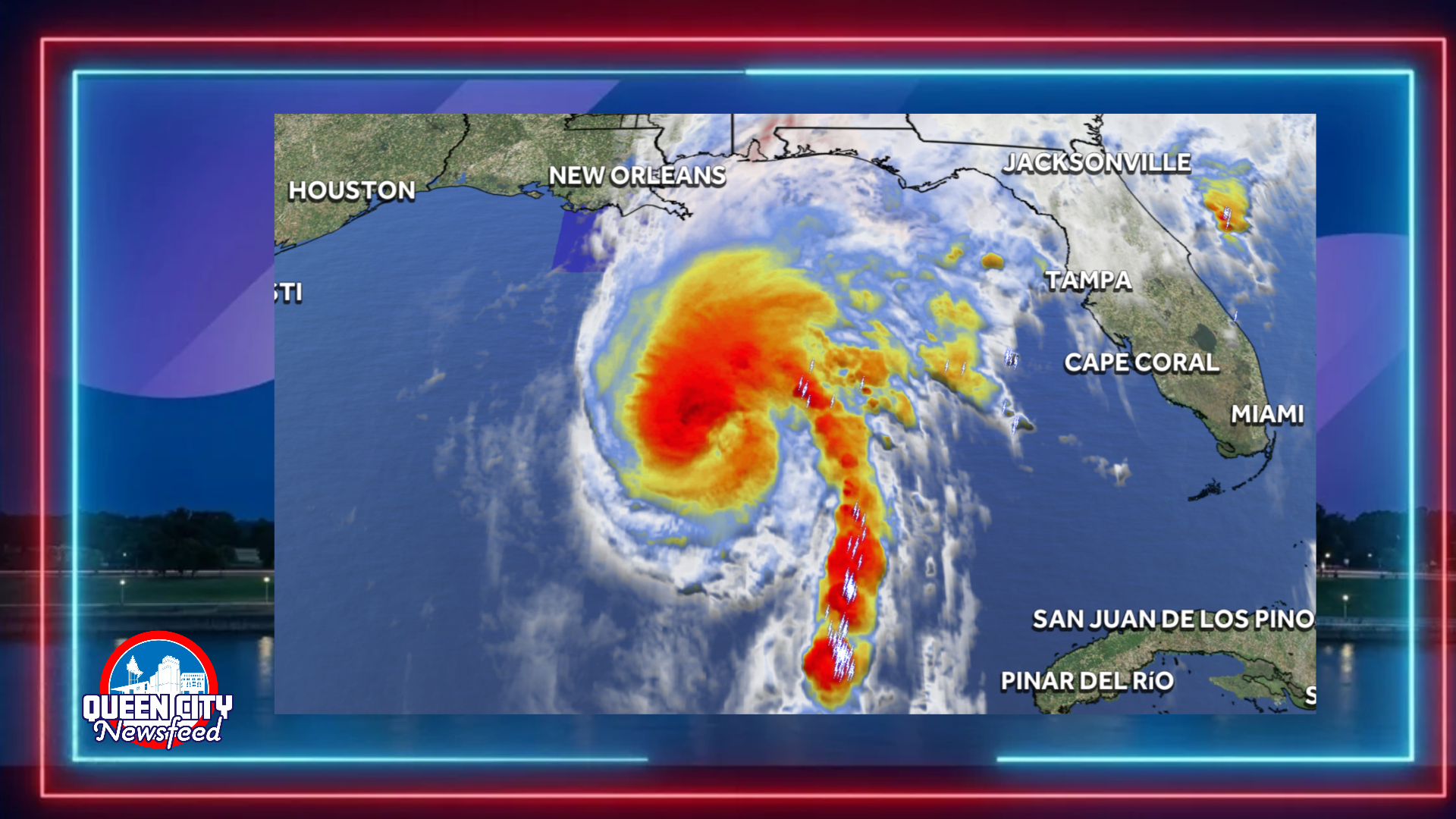
MERIDIAN, Miss. (Queen City Newsfeed), Forecasters now expect Isaias to become a major hurricane early Friday as it churns across the Gulf toward the northern Gulf Coast.
The National Hurricane Center’s 10 p.m. Thursday forecast calls for Isaias to reach 115 mph by early Friday morning. That would make it a Category 3 storm, the threshold for a major hurricane. The hurricane center added the major hurricane peak to its forecast in this latest update.
Why Forecasters Raised the Forecast
Isaias already had maximum sustained winds of 105 mph Thursday night, making it a strong Category 2 hurricane. Its satellite appearance improved over the past few hours, and recent images showed signs of an eye forming.
Forecasters pointed to warm, deep Gulf water and favorable conditions in the upper atmosphere. Together, those could allow Isaias to strengthen overnight. In addition, most members of a Google DeepMind forecast model ensemble showed Isaias briefly reaching major hurricane status early Friday. Some hurricane models showed the same trend. The hurricane center then added that peak to its official forecast.
Hurricane Hunter aircraft from the Air Force and NOAA planned to fly into the storm overnight. Their data will help confirm how strong Isaias has become.
Peak Expected to Be Short Lived
Forecasters expect Isaias to hold major hurricane strength only briefly. Upper level winds will strengthen Friday and should weaken the storm before landfall. The latest forecast shows winds near 100 mph as the center approaches the coast Friday evening.
Still, the hurricane center stressed that Isaias will remain dangerous. Forecasters expect significant storm surge, damaging winds and flooding rain along the northern Gulf Coast.
Landfall Friday Night or Early Saturday
Isaias moved northeast at about 14 mph Thursday night. Forecasters expect it to turn north and speed up Friday. Landfall should occur within the hurricane warning area Friday night or early Saturday.
A Hurricane Warning covers portions of southern Mississippi, southern Alabama and the Florida Panhandle. The hurricane center expects a life threatening storm surge from the Mouth of the Mississippi River to Suwannee, Florida. Residents there should follow instructions from local officials and leave immediately if told to evacuate.
What East Mississippi Can Expect
After landfall, the forecast track carries Isaias north into west central Alabama by Saturday morning. By then, forecasters expect it to weaken to a tropical storm with winds near 50 mph.
The storm’s wind field should also expand, so impacts will reach well away from the center. The hurricane center listed extreme eastern Mississippi among the areas that could see damaging wind gusts. More Tropical Storm and High Wind Watches and Warnings may be issued for parts of that region late Thursday night or Friday.
Heavy rain is also likely across much of the Southeast from Friday into the weekend. Forecasters said considerable flash flooding, urban flooding and significant river flooding are possible.
Queen City Newsfeed will continue to update this story as new information becomes available.